Here are the maps for "The Democratic Armada of the Caribbean."
Europe 1400-1700 Four Maps
Central America and the Caribbean Political Map
Carribean Sea with Islands and Names Map
Atlas of the Caribbean 1803-1983 Maps
Sovereign States of the Caribbean Map
Dependent Areas and Subsidiary States of the Caribbean Map
Haunts of the Brethren of the Coast Map
Caribbean Lesser Antilles Map
North America in 1648 Map
North America in 1789 Map
North America in 1837 Map
United States of America in 1648 Map
United States of America in 1789 Map
United States of America in 1837 Map
Mexico and Central America in 1837 Map
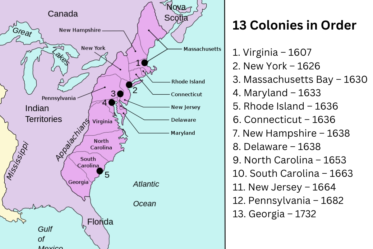
United States of America State 13 Colonies Labeled Map
United States of America State 13 Colonies in Order
United States of America State Land Claims and Cessions 1782-1802
United States of America Civil War Free vs Slave States Map
United States of America Territorial Expansion 1783-1898 Map
Rhode Island Map
Rhode Island and Southern New England Tribes in 1636 Map
Rhode Island Tribes Map
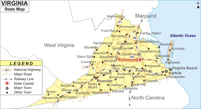
Virginia State with Towns Map
Virginia Smith Island Map
Virginia Smith Island Closeup Map
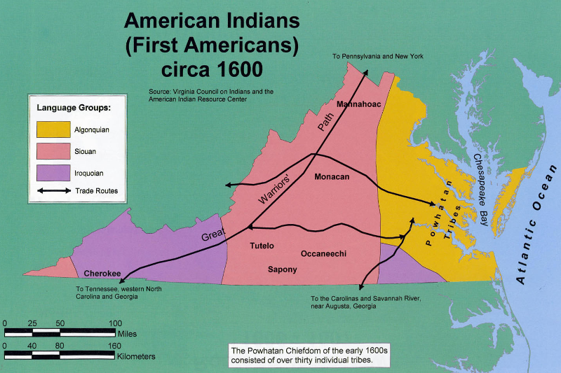
Virginia Tribes in 1600 Map
Virginia Tribes Map
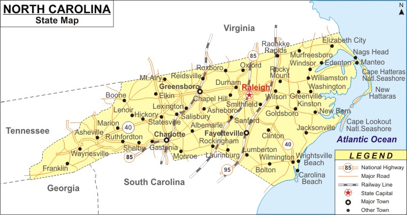
North Carolina State Map
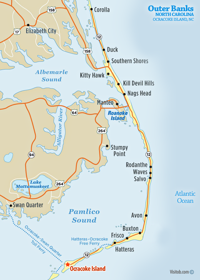
North Carolina Outer Banks Closeup with Okracoke Island Map
North Carolina Tribes in 1600 Map
North Carolina Tribes Map
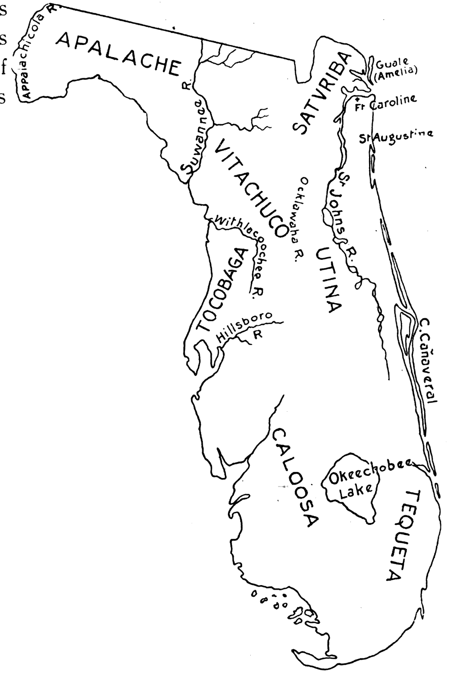
Florida with Islands Map
Florida Indian Tribes in 1600 Map
Florida Indian Tribes Map
The Seminoles were not originally a single tribe. They were an alliance of Northern Florida and Southern Georgia natives that banded together in the 1700's to fight the European invaders, including people from the Creek, Miccosukee, Hitchiti and Oconee tribes. Later the alliance became even closer, and today the Seminoles are a united sovereign nation, even though their people speak two languages and have different cultural backgrounds.
The original homelands of Florida's Creek and Miccosukee Indians were in the northern part of the state, but since the native tribes of southern Florida had been conquered and shipped to Cuba by the Spanish, the Seminoles retreated into that area, where most Seminole people are still living today. (Other Seminoles were removed to Oklahoma by the US government.)
Florida Seminole Migration Map
Louisiana Tribes in 1700 Map
Louisiana Tribes Map
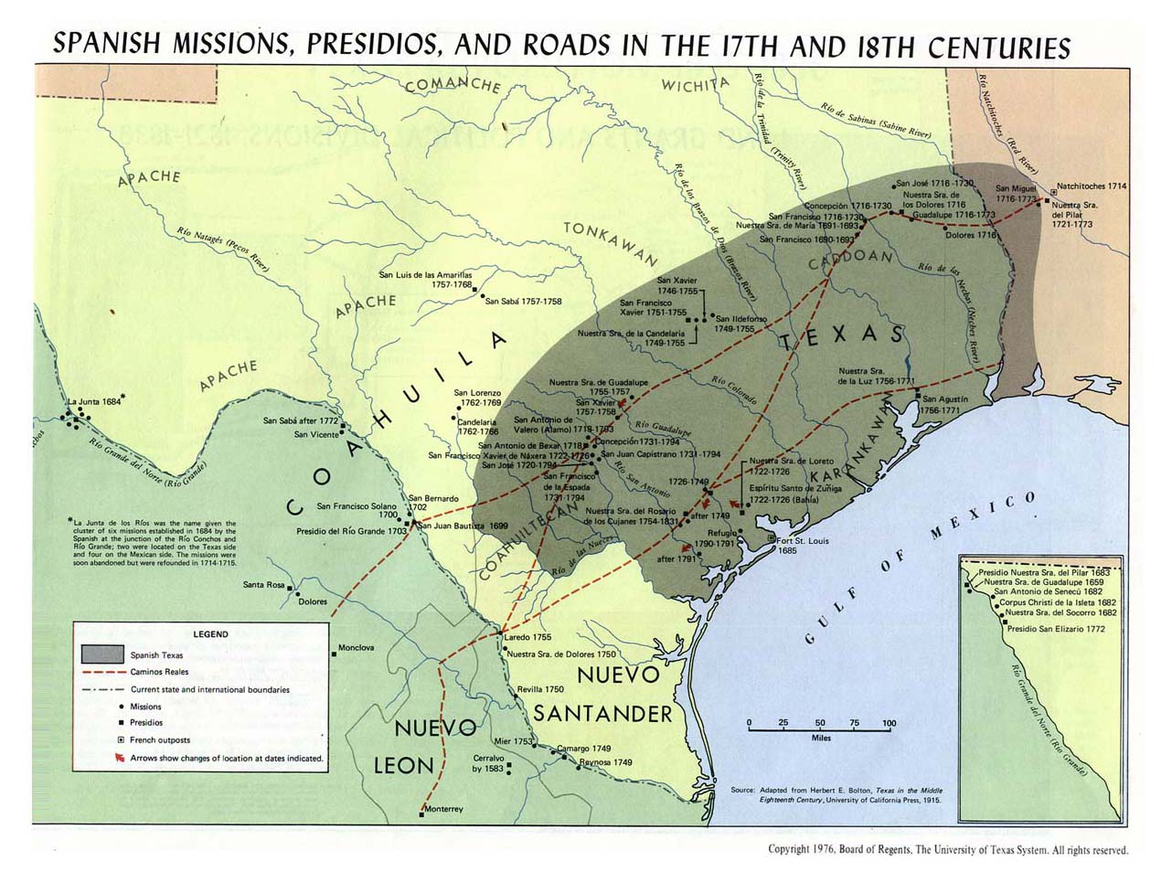
Texas in 1600s-1700s Map
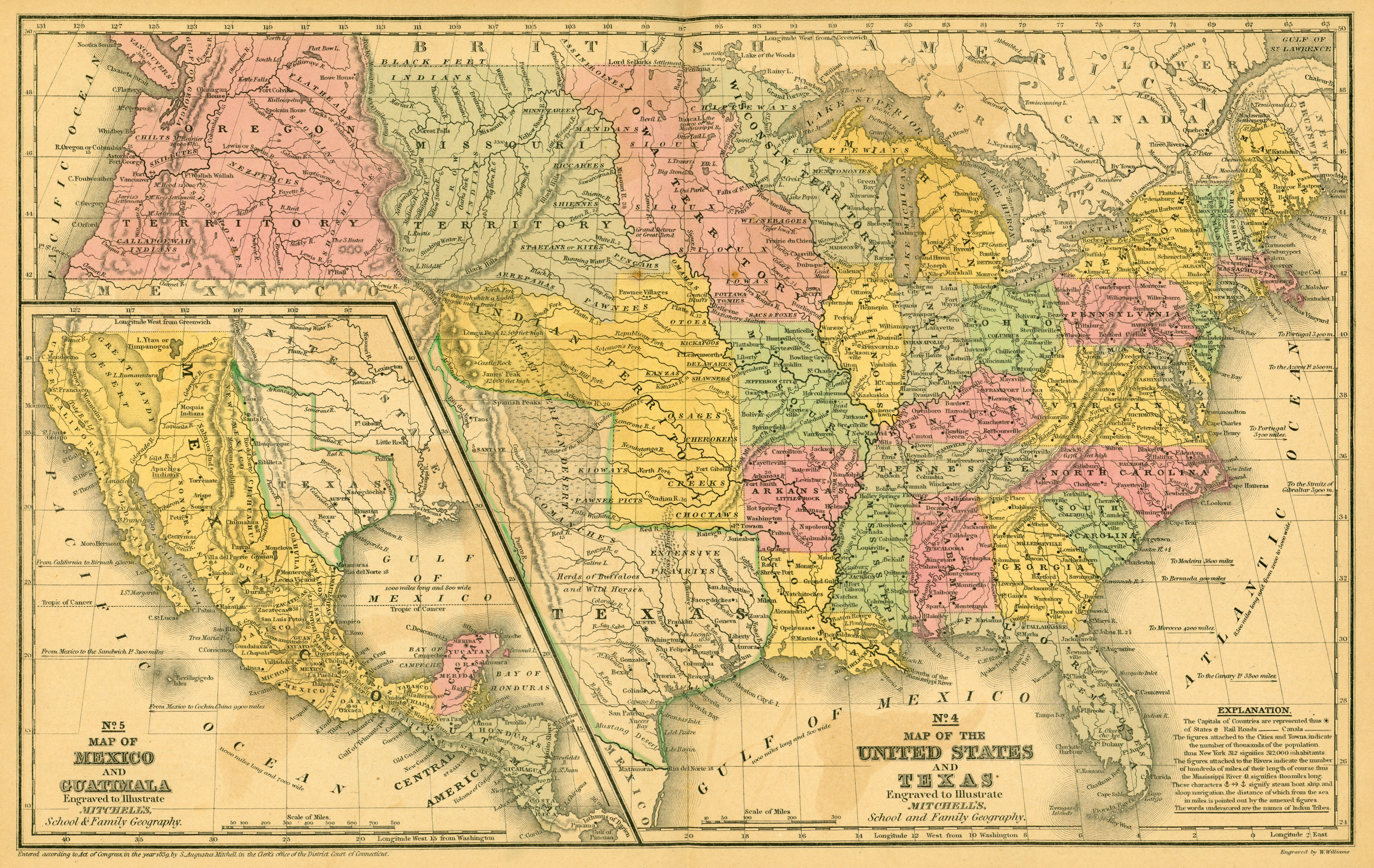
Texas and United States of America in 1839 Map
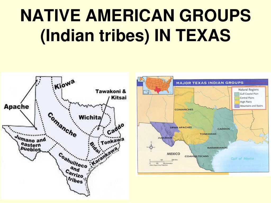
Texas Tribes Map
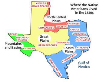
Texas Tribes in 1820s Map
Europe 1400-1700 Four Maps
Central America and the Caribbean Political Map
Carribean Sea with Islands and Names Map
Atlas of the Caribbean 1803-1983 Maps
Sovereign States of the Caribbean Map
Dependent Areas and Subsidiary States of the Caribbean Map
Haunts of the Brethren of the Coast Map
Caribbean Lesser Antilles Map
North America in 1648 Map
North America in 1789 Map
North America in 1837 Map
United States of America in 1648 Map
United States of America in 1789 Map
United States of America in 1837 Map
Mexico and Central America in 1837 Map
United States of America State 13 Colonies Labeled Map
United States of America State 13 Colonies in Order
United States of America State Land Claims and Cessions 1782-1802
United States of America Civil War Free vs Slave States Map
United States of America Territorial Expansion 1783-1898 Map
Rhode Island Map
Rhode Island and Southern New England Tribes in 1636 Map
Rhode Island Tribes Map
Virginia State with Towns Map
Virginia Smith Island Map
Virginia Smith Island Closeup Map
Virginia Tribes in 1600 Map
Virginia Tribes Map
North Carolina State Map
North Carolina Outer Banks Closeup with Okracoke Island Map
North Carolina Tribes in 1600 Map
North Carolina Tribes Map
Florida with Islands Map
Florida Indian Tribes in 1600 Map
Florida Indian Tribes Map
The Seminoles were not originally a single tribe. They were an alliance of Northern Florida and Southern Georgia natives that banded together in the 1700's to fight the European invaders, including people from the Creek, Miccosukee, Hitchiti and Oconee tribes. Later the alliance became even closer, and today the Seminoles are a united sovereign nation, even though their people speak two languages and have different cultural backgrounds.
The original homelands of Florida's Creek and Miccosukee Indians were in the northern part of the state, but since the native tribes of southern Florida had been conquered and shipped to Cuba by the Spanish, the Seminoles retreated into that area, where most Seminole people are still living today. (Other Seminoles were removed to Oklahoma by the US government.)
Florida Seminole Migration Map
Louisiana Tribes in 1700 Map
Louisiana Tribes Map
Texas in 1600s-1700s Map
Texas and United States of America in 1839 Map
Texas Tribes Map
Texas Tribes in 1820s Map
(no subject)
Date: 2024-12-23 02:42 pm (UTC)North America in 1648 Map gets a 403 error
United States of America in 1648 Map gets a 403 error
North Carolina Outer Banks Closeup with Okracoke Island Map "stop this image was hotlinked"